How to Read Buoys and Channel Markers: Red Right Returning and the U.S. Aids to Navigation System
Learn what the red and green buoys, daymarks and lights are telling you: red right returning, nuns and cans, odd and even numbers, preferred channel, safe water, isolated danger, the orange-and-white regulatory and information markers, the yellow symbols on the Intracoastal Waterway and how the Western Rivers system differs. Based on the Coast Guard's U.S. Aids to Navigation System rules (33 CFR Part 62).
Time
30 min
Applies to
All engines
Safety first: Buoys drift, sink and get dragged off station, so never rely on a single buoy to find your position; check it against your chart, your depth sounder and landmarks. Don't pass buoys or beacons close aboard: their moorings, rock bases and the hazard they mark can hole your boat. Never tie up to a navigation aid; federal rules prohibit it. In fog, slow down and use sound and electronics too (see our fog guide).
Owners often ask
- Which side do I keep the red buoys on when I am heading out of the inlet?
- What do the yellow triangles and squares on Intracoastal Waterway markers mean?
This guide walks you through it. Still stuck? Ask the AI Mechanic about your engine.
Tools
- Up-to-date chart of your area (paper chart or chartplotter/app)
- Binoculars
- Spotlight for reading markers at night
Before you start
What the system is. The Coast Guard maintains the U.S. Aids to Navigation System, a mostly lateral system: colors, shapes, numbers and lights mark the sides of navigable channels, supplemented by non-lateral marks for dangers, safe water and regulations. U.S. waters follow IALA Region B (the system used in the Americas). U.S. territories west of the International Date Line and south of 10 degrees north latitude follow Region A, where red and green are reversed (33 CFR 62.21 and 62.25).
Charts come first. The rules say the system is designed for use with nautical charts: a marker's exact meaning may not be clear until you see where it sits on the chart relative to the channel and hazards. Keep an up-to-date chart aboard and check the Local Notice to Mariners (on the Coast Guard Navigation Center site) for buoys that have been moved, removed or are off station.
Two kinds of aids.
- Beacons are fixed to the bottom or shore (from single piles to lighthouses). Unlighted beacons are daybeacons, with a colored shape called a daymark. Lighted ones are called lights.
- Buoys float, moored by chain to a sinker. Their color and shape are the daymark.
Steps
Lateral marks are arranged for a boat returning from sea, heading upstream or toward the head of navigation. Where there's no clear "from sea," the direction generally runs clockwise around the U.S.: southward along the Atlantic coast, westward from Florida to Texas along the Gulf coast and northward along the Pacific coast (33 CFR 62.21). On lakes and in confusing areas, the chart tells you.
When you're returning (going in the conventional direction), keep the red marks on your right (starboard) side and the green marks on your left (port). Heading out to sea (or downstream), it's the reverse: red on your left. Picture the channel as a road with red curbs on the right as you come home.
- Red marks (starboard hand): buoys are nuns, with a tapered cone-shaped top, or pillar buoys; daybeacons have red triangular daymarks.
- Green marks (port hand): buoys are cans, cylindrical, or pillar buoys; daybeacons have green square daymarks.
The shape matters at dawn, dusk or in glare when color is hard to see, and it's the same meaning in both IALA regions. Pillar buoys (a wide base with a framework tower, often with a light, bell or horn) carry the meaning in their color.
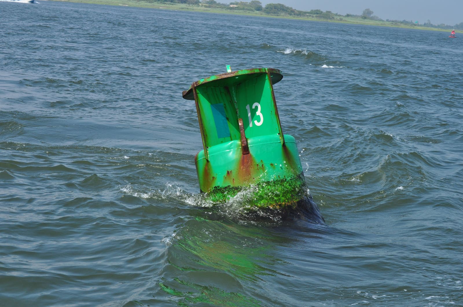
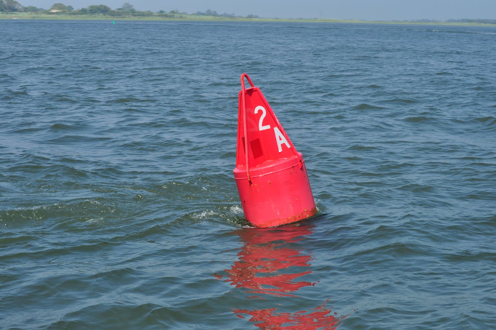
A green can: keep it to port (your left) when returning from sea. Note how far it leans in the current. Photo: Joe Mabel / Wikimedia Commons · CC BY-SA 3.0 Solid red aids carry even numbers and solid green aids carry odd numbers, and the numbers increase as you go in the conventional direction (in from sea). Numbers are kept roughly in step on both sides, so some may be skipped. A letter suffix (like the "2A" on the cover photo) marks an aid added to an existing sequence or the first aid of a waterway (33 CFR 62.43). If the numbers are going down, you're heading out.
On lateral aids, green lights mark the port side and red lights the starboard side of the channel when returning, with a regular flashing (or occulting) rhythm. A quick flashing light (about 60 flashes a minute) warns of a sharp turn, sudden narrowing, wreck or obstruction. White and yellow lights have no lateral meaning (except on the Western Rivers, step 10); read the aid's shape, color and number instead. Some lights show different colored sectors over hazards, shown on the chart; treat sectors as a warning, not an exact bearing (33 CFR 62.45). Your chart lists each light's color and rhythm, and a spotlight helps you read numbers and reflectors. See our night boating guide.
Where a channel splits, or a wreck can be passed on either side, you'll see a mark with red and green horizontal bands. The top band's color tells you the preferred (main) channel:
- Green on top: treat it as a green (port hand) mark to follow the preferred channel when returning; it's a can or pillar buoy or a square daymark.
- Red on top: treat it as a red (starboard hand) mark for the preferred channel; it's a nun or pillar buoy or a triangular daymark.
Lit preferred channel marks show a composite group flash (two flashes then one), in the color of the top band (33 CFR 62.25 and 62.45). Check the chart before you choose the secondary channel.
- Safe water marks: red and white vertical stripes. Navigable water all around; they often mark a fairway, mid-channel or the seaward end of a channel. Buoys are spherical or carry a red ball topmark; daybeacons have an octagonal daymark. Lit ones flash white Morse code "A" (short-long) (33 CFR 62.27 and 62.45).
- Isolated danger marks: black with red horizontal bands and two black balls on top. They sit on or near a danger that can be passed on all sides, but don't approach closely. Lit ones show a white group flash of two (33 CFR 62.29).
- Special marks: solid yellow. Not for navigation; they mark anchorages, cable or pipeline areas, military or research areas and similar. Check the chart (33 CFR 62.31).
- Mooring buoys: white with a blue horizontal band (33 CFR 62.35).
These are the markers you'll see most on lakes and near shore: white buoys or signs with orange shapes (33 CFR 62.33):
- Open diamond: danger (rocks, shoals, dams, stumps); the hazard is often written inside.
- Diamond with a cross inside: boats keep out (swim areas, dams, spillways).
- Circle: operating restrictions, such as slow/no wake, speed limits or no PWCs; the rule is written in the circle.
- Square or rectangle: information, such as directions, distances or where to find fuel or food.
A regulatory buoy is white with two orange bands, one near the top and one just above the waterline. On some inland state waters you may also see a black-and-white vertically striped buoy: it means an obstruction extends from the nearest shore to the buoy, so don't pass between the buoy and the shore (33 CFR 62.32).
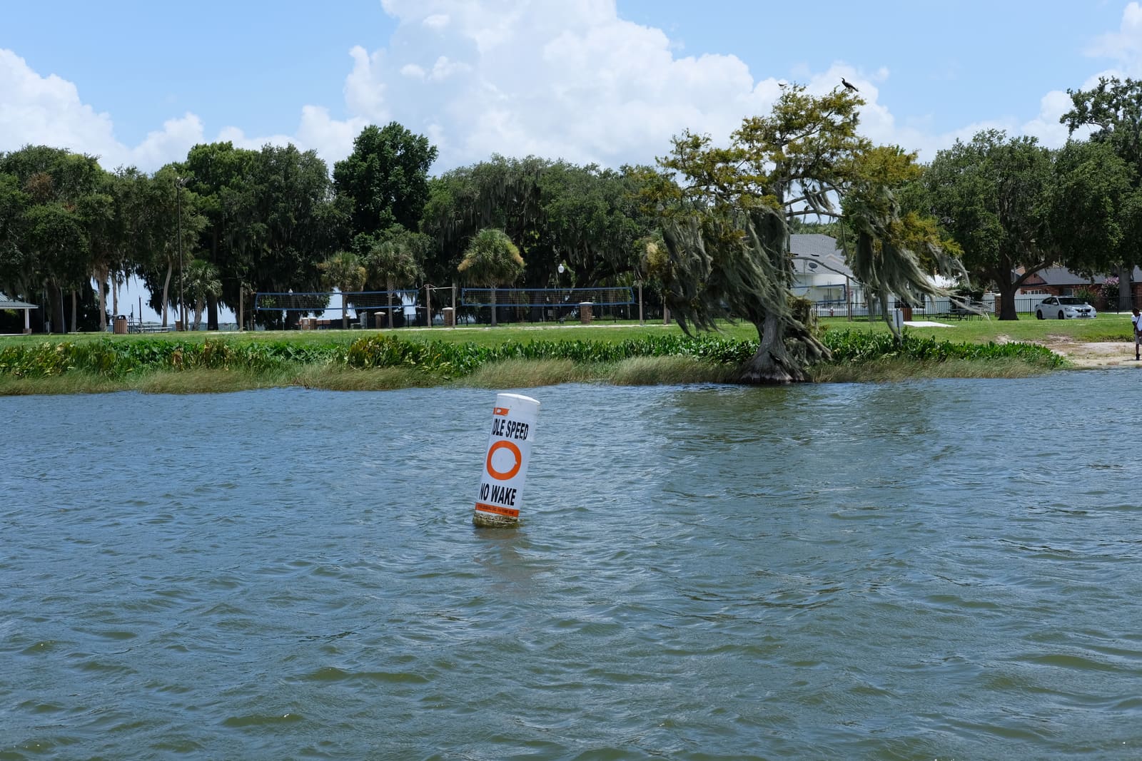
An orange circle on a white buoy means an operating restriction; this one is a slow speed, no wake zone. Photo: Tobyw87 / Wikimedia Commons · CC BY 4.0 Along the ICW, aids carry yellow symbols in addition to their normal colors (33 CFR 62.49):
- Yellow triangle: keep the aid on your starboard (right) side, regardless of its color or number.
- Yellow square: keep the aid on your port (left) side, regardless of its color or number.
- Yellow horizontal band: identifies an ICW aid but gives no side information.
These meanings apply when going south along the Atlantic coast and west along the Gulf coast (and westward on the Okeechobee Waterway). Where the ICW shares a stretch with a channel that leads in from sea, the regular red and green may say one thing and the yellow symbol the other: if you're following the ICW, follow the yellow symbol.
On the Mississippi River and its tributaries above Baton Rouge, and certain other rivers flowing to the Gulf, the Western Rivers Marking System applies (33 CFR 62.51):
- Buoys aren't numbered.
- Numbers on beacons show river mileage from a fixed point (usually the mouth), not port/starboard.
- Diamond-shaped crossing dayboards (checkered red-and-white or green-and-white) mark where the channel crosses from one bank to the other.
- Lights on green buoys and green-daymark beacons show a single flash (green or white); on red ones, a double flash (red or white).
- Isolated danger marks aren't used.
River channels also shift with water levels, so check local notices and river charts.
The Coast Guard warns that buoy positions on charts are approximate, buoys swing on their moorings within a "watch circle," and storms, ice, current or collisions can move, sink or capsize them (33 CFR 62.23). Sound signals on buoys (bells, gongs, whistles) are driven by the waves, so they may be silent in calm water, and you can't judge distance by how loud they sound (33 CFR 62.47). Cross-check every buoy with your chart, depth sounder, GPS and landmarks.
Federal law prohibits tying up to, damaging, moving or otherwise interfering with a Coast Guard aid to navigation, with fines and possible jail time (33 CFR 70.05-1 and 70.05-5). If you hit one, report it; the rules require a report. If you notice a buoy missing, off station or a light out, tell the Coast Guard (for example on VHF channel 16 or through the Navigation Center site) so others don't get hurt.
How to make a useful report. The Navigation Center has an online ATON Discrepancy Report form. It asks for your contact details, the state, the aid's name as listed in the Light List, and what's wrong (a lighted aid that's out or flashing wrong, or another problem such as missing, damaged or off station). Before you report, note the aid's number and color, your GPS position and the time, and snap a photo if it's safe. If a missing aid leaves a real hazard (a wreck or rock with no mark), call the Coast Guard on VHF 16 right away instead of waiting for a form.
Check the weekly notices before a trip. Each Coast Guard district publishes a weekly Local Notice to Mariners on the Navigation Center site, listing aids that are discontinued, relocated, damaged or temporarily changed, plus dredging, bridge work and marine events. Skim your district's latest notice before a long run in unfamiliar water; a buoy that "isn't where the chart says" is often already listed there.
Common mistakes
- Forgetting that "red right returning" flips when you head out to sea.
- Cutting between a buoy and the shore, or between two buoys that don't make a pair, to save a few minutes.
- Passing a buoy close aboard and hitting its chain or the rock it marks.
- Following ICW reds and greens and ignoring the yellow triangles and squares.
- Treating an orange-and-white "no wake" or "danger" buoy as advice instead of a rule.
- Trusting a buoy's charted position after a storm.
- Tying up to a channel marker to fish.
When to call a pro
- You're lost, aground or taking on water: call TowBoatUS, Sea Tow or the Coast Guard on VHF 16
- You find a missing, damaged or off-station aid, or you hit one: report it to the Coast Guard
- You're new to a busy or tricky waterway: take a local navigation course from the Coast Guard Auxiliary or U.S. Power Squadrons, or ride along with an experienced local captain first
Tips
- Before each trip, trace your route on the chart and note the first few buoy numbers you expect to see.
- At night, carry a strong spotlight and sweep it briefly to pick up reflectors and numbers, then turn it off so you don't blind other boaters.
- When a channel is confusing, slow down and look ahead for the next pair of markers before committing.
- Teach kids "red right returning" and let them call out the numbers; it keeps everyone watching.
Official references
We read these to write this guide. Your engine's own manual always wins.
- eCFR – 33 CFR Part 62, United States Aids to Navigation System
- eCFR – 33 CFR Part 70, Interference With or Damage to Aids to Navigation
- U.S. Coast Guard Boating Safety – Navigation Rules (and the U.S. Aids to Navigation System)
- BoatUS Magazine – Rules-Of-The-Road Refresher For Boaters (2015)
- U.S. Coast Guard Navigation Center – ATON Discrepancy Report Form
- U.S. Coast Guard Navigation Center – Local Notices to Mariners
Safety: BoatMend is for information only and does not replace a certified marine technician. You are responsible for your safety and your boat. Read the full disclaimer.
Last updated 2026-10-26
Related guides
Boating in Fog: When to Stay In, Sound Signals, Safe Speed and Using Your Electronics
Fog can roll in on any lake, bay or coast. Learn when to stay at the dock, the fog signals the Coast Guard rules require, how slow is slow enough, how to use radar, AIS and your chartplotter without trusting them blindly, and when to simply anchor and wait it out.

Right-of-Way on the Water: The Navigation Rules Every Recreational Boater Should Know
There are no lanes or stop signs on the water, so the Navigation Rules decide who keeps course and who gets out of the way. Learn stand-on and give-way, meeting head-on, crossing, overtaking, sail versus power, narrow channels, big ships, safe speed and keeping a proper lookout, with the rule numbers from the U.S. Inland Navigation Rules (33 CFR Part 83).
How to Test and Fix Your Boat's Navigation Lights
Learn which navigation lights your boat must show and when, then test them and fix the usual culprits such as corroded sockets, loose pole-light plugs and blown bulbs. Working lights are legally required at night and in poor visibility and are how other boats see which way you are heading.
Boating at Night: Lights, Speed, Night Vision and Reading Other Boats
Get ready for a safe run after dark, from checking your navigation lights and dimming the helm to slowing down, reading other boats' lights and buoys, keeping life jackets on and leaving the alcohol ashore.
Boater Education Cards: Who Needs One, How to Get It and When It Works in Other States
Most states require some boat operators to complete an approved boating safety course and carry proof. Learn how to find your state's rule (age, horsepower, boat type), pick a NASBLA-approved course, get the card, use it when you visit other states, and what rental and other exemptions usually look like. Practical guidance, not legal advice.
Boat Horns and Sound Signals: Requirements, Testing and the Signals Every Skipper Should Know
Every boat needs a way to make an efficient sound signal, and bigger boats need a proper whistle or horn. Learn the Coast Guard requirements by boat length, how to test and fix an electric horn, why a canister air horn makes a good backup, and the basic passing, danger and fog signals.
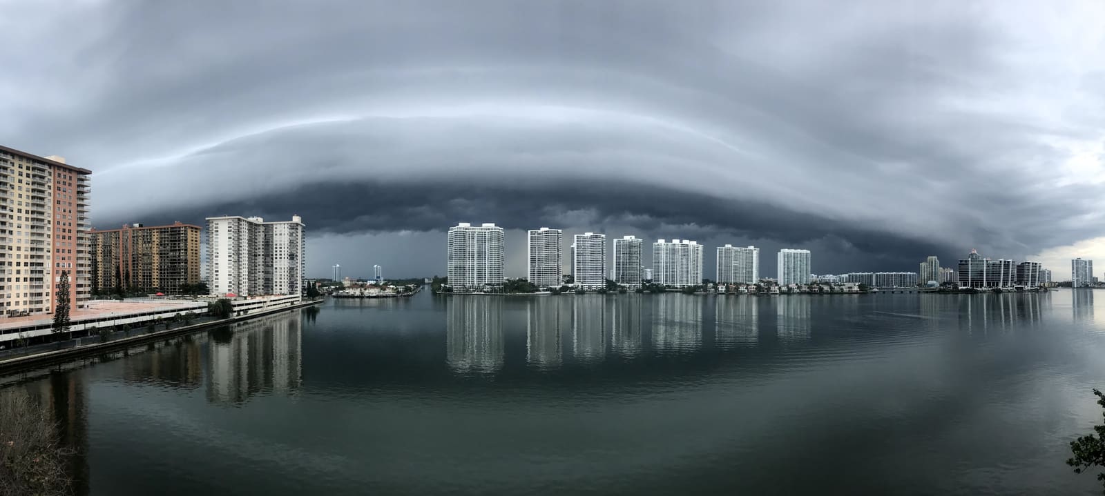
Reading Marine Weather Forecasts: Advisories, Wind, Waves and Go/No-Go
Learn where to get the official NOAA marine forecast for your waters, what small craft advisories and warnings really mean, how to read wind and wave numbers, and how to make a simple go/no-go call before you leave the dock.
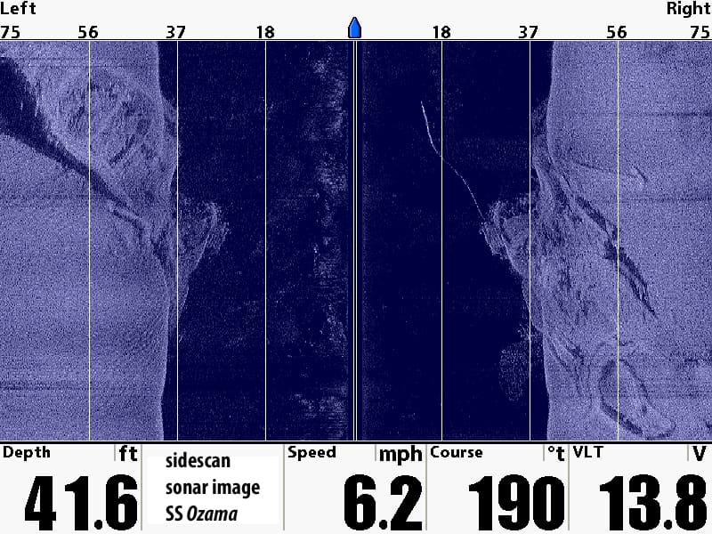
Fish Finder Settings: How to Tune Your Sonar for a Clearer Picture
Get more out of your fish finder by setting frequency, gain (sensitivity), range, contrast, color palette and noise filters on purpose instead of leaving everything on auto, plus how to set the depth offset and track down interference from other electronics.
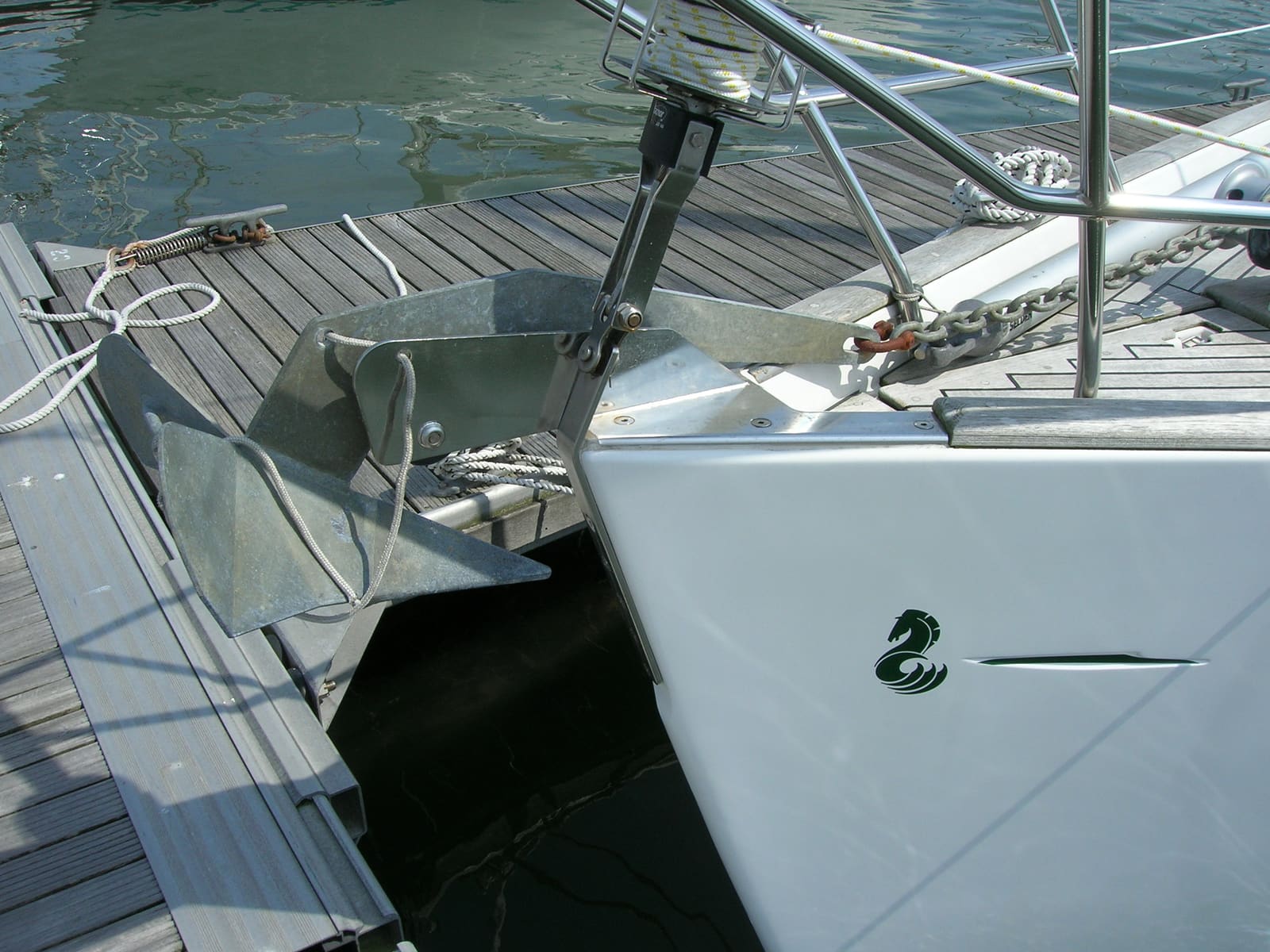
Anchor Basics: Choosing the Anchor, Rode and Scope, Setting It and Checking Your Gear
Match your anchor to the bottom you usually anchor in, put together a chain-and-nylon rode, let out enough scope for the depth and weather, set and check the anchor, use an anchor alarm, and inspect the rode, splices and shackles every season so the weakest link isn't hiding in your ground tackle.